

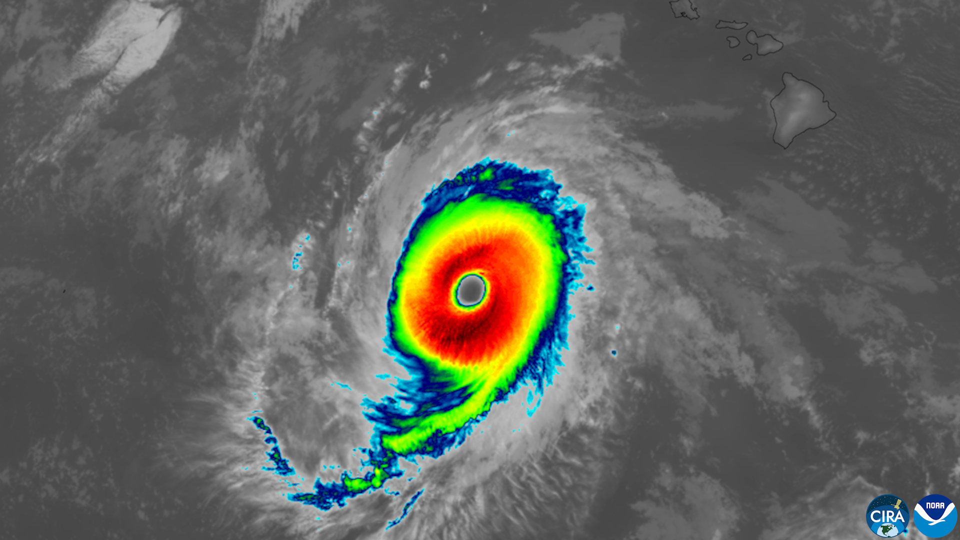
Hurricane Nolo strengthened into a Category 4 storm with sustained winds of 155 mph as it passed south of Hawaii’s Big Island on 28 September, dumping heavy rain that triggered flooding before the storm began weakening, according to the National Hurricane Center and news reports.
Days of Heavy Rain
Although Nolo did not make landfall and stayed well south and southwest of the main Hawaiian islands, its outer bands brought rainfall totals of up to 20 inches to the eastern and southern Big Island, with some locations, including Laupahoehoe, recording nearly 22 inches, according to reports citing local weather data. Maui saw four to eight inches of rain, while the rest of the state received lighter totals. The National Hurricane Center warned of “life-threatening surf and rip current conditions” along south-facing shores as swells from the storm reached the islands, and state parks on the Big Island and Maui were closed as a precaution.
Federal Emergency Support
President Trump approved an emergency declaration for Hawaii, Governor Josh Green’s office said, releasing federal resources to support the state’s response. Forecasters said Nolo was expected to weaken through the middle of the week as increasing wind shear degraded the storm’s structure, with its track continuing west and away from the islands. The storm’s approach also prompted concern for the Papahanaumokuakea Marine National Monument, a roughly 582,000-square-mile protected conservation area northwest of the main islands that lay near its projected path, according to forecasters.
Why It Matters
Even without making landfall, Nolo’s rainfall totals rank among the heaviest a Pacific storm has delivered to Hawaii in recent years, underscoring how close-passing hurricanes can still produce serious flooding and safety hazards for island communities that a track forecast alone might not convey, and how federal disaster declarations increasingly follow storms that never come ashore.


Leave a Reply