

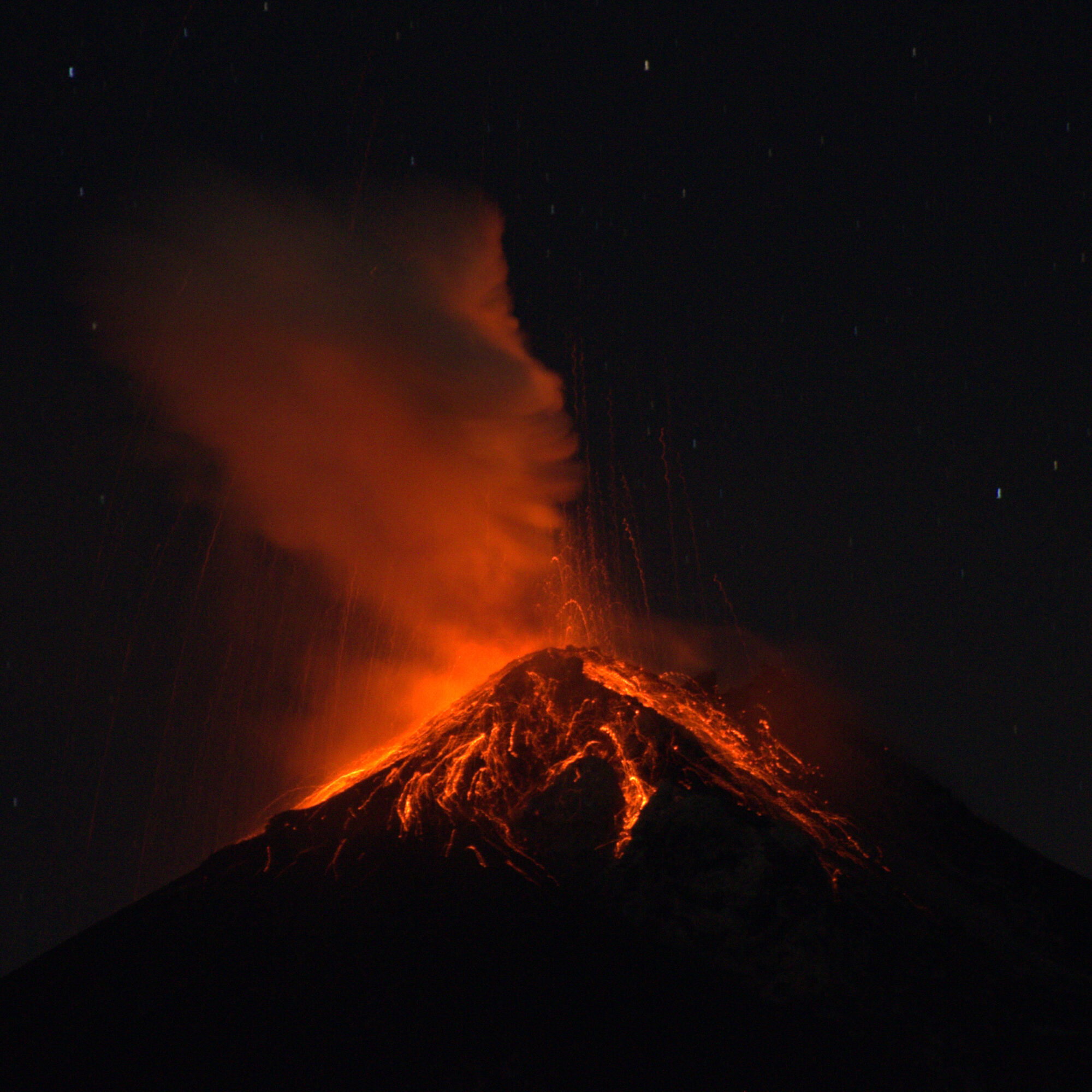
Guatemala’s Fuego volcano entered a full paroxysmal eruption late on 3 August 2026, sending pyroclastic flows up to seven kilometres down six ravines and lava fountains 200 to 300 metres above the crater, according to volcano-monitoring reports. The country’s disaster coordination agency, CONRED, evacuated approximately 1,700 people from at least 18 communities, including residents of El Porvenir and Las Lajitas, and closed National Route 14, a major highway linking Guatemala City to the Pacific coast.
Fifty Hours of Activity
The eruption’s strongest phase lasted roughly 50 hours, with ash-and-gas columns rising to between 5,000 and 6,000 metres above sea level and drifting more than 40 kilometres westward. Guatemala’s national institute for seismology and volcanology, INSIVUMEH, declared the intense phase over on 6 August, after CONRED had raised its alert to Institutional Orange, the second-highest level on its scale.
Lingering Lahar Risk
Although evacuees were cleared to return home once the eruption eased, authorities warned that rain from an incoming tropical weather system could remobilise the freshly deposited ash and volcanic debris into lahars, the fast-moving mudflows that have caused some of Fuego’s deadliest incidents in the past. Officials asked residents in ravine-adjacent communities to remain cautious in the eruption’s aftermath, and emergency crews continued monitoring rainfall forecasts in the days that followed to gauge the risk of remobilised ash turning into fast-moving flows.
Why It Matters
Fuego is one of Central America’s most active volcanoes, sitting close to densely populated areas of Guatemala, and its eruptions have previously caused significant loss of life when pyroclastic flows or lahars reached inhabited zones with little warning. The absence of confirmed deaths or major structural damage this time reflects the evacuation and alert systems built up since Fuego’s catastrophic 2018 eruption, which killed hundreds of people, though officials continue to monitor the volcano closely for renewed activity. The closure of National Route 14, even temporarily, also underlined how a single eruption can disrupt commerce far beyond the immediate danger zone, given the highway’s role connecting the capital to Pacific coast ports.
Leave a Reply